
3D Laser Scanning
We capture buildings, interiors, and sites with millimetre-grade accuracy using the latest LiDAR scanners—so every m² is measured, verified, and ready for design, construction, or asset management.
Made for Precision & Clarity
.jpg)

Every Millimetre Counts - Scan Before You Design
Reach out to the team directly and we’re happy to help.
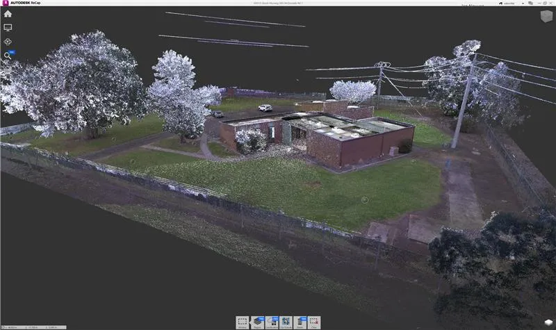
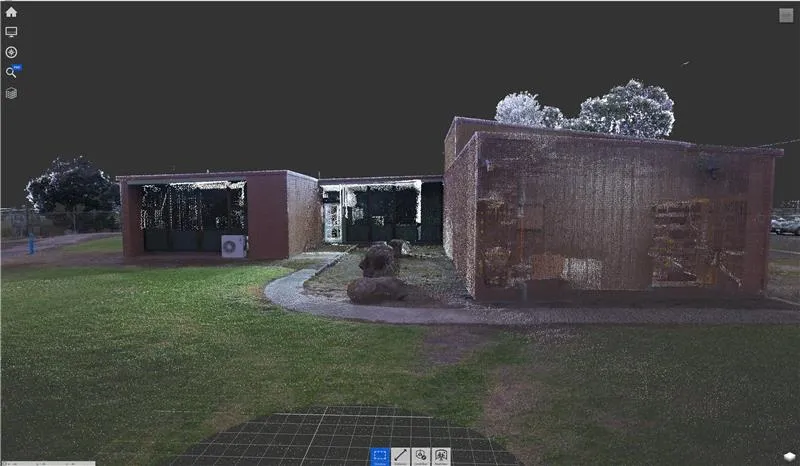
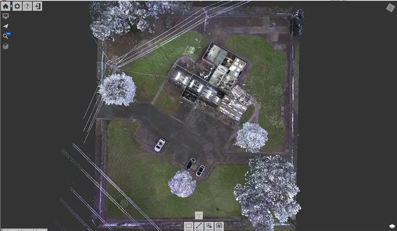
3D Scanning for High-Precision Building and Site Measurement
At GeospatialWorx, we specialise in 3D laser scanning to capture buildings, interiors, and sites with millimetre accuracy. Using the latest Leica technology, our scans form the digital foundation for projects in design, construction, and asset management — ensuring that every m² is measured, documented, and verified with confidence.

What Is 3D Laser Scanning?
3D laser scanning is a non-invasive measurement method that uses laser pulses to record millions of data points in seconds. These points form a highly accurate digital model of real-world environments, known as a point cloud, which can be used to generate 2D plans, 3D models, and detailed spatial analyses.
This technology allows architects, engineers, and property professionals to visualise, plan, and verify spaces with unmatched precision — even in complex or hard-to-reach areas.
Why Use 3D Scanning?
- Unmatched Accuracy – Capture as-built conditions down to millimetre precision.
- Time-Efficient – Scan large areas quickly with minimal disruption to operations.
- Rich Data Output – Generate point clouds, sections, floor plans, and 3D Revit models from one dataset.
- Reduced Risk – Eliminate manual measurement errors and avoid rework or costly discrepancies.
- Versatile Applications – Perfect for existing conditions surveys, design coordination, heritage documentation, and verification.
Our Process
1. On-Site Scanning
We deploy Leica 3D Laser Scanners to capture complete 3D data of your building and site. Control via a total station is also applied to ensure a high degree of accuracy.
2. Data Registration
Scans are aligned and combined using Leica Cyclone REGISTER 360, ensuring spatial accuracy and global control when required.
3. Data Optimisation & Quality Assurance
Once the individual scans have been aligned and processed into a single unified point-cloud we carry out an review and clean up of the 3D data.
4. Delivery
3D Laser scan data is supplied typically in .RCP or .E57 formats - from there and as an optional element we can produce any drawing outputs you require of the pointcloud data at a seperate cost.
Made for
- Architects and Designers – Develop designs on verified, as-built geometry.
- Construction Professionals – Coordinate and validate builds against design intent.
- Asset and Facility Managers – Maintain digital twins for long-term maintenance and compliance.
Technology We Use
- Leica 3D Laser Scanners
- Topcon Total Stations
- Leica Cyclone REGISTER 360
- Leica Field 360
Deliverables Available
- E57
- RCP
GeospatialWorx delivers accurate, reliable, and future-ready 3D data so you can design, plan, and manage your assets with measurable certainty — making every m² count.
Every Millimetre Counts - Scan Before You Design
Reach out to the team directly and we’re happy to help.
Frequently Asked Questions
Can you provide drawings and revit models prepared from the scan data?
Yes we can produce any type of deliverable plan/model from a pointcloud when scoped.
Will scanning disrupt operations?
Scanning is fast and non-invasive. We routinely work around live environments and schedule access to minimise impact.
How much data can be captured with a scanner?
Everything visible in colour. 1 scan captures approxiamtely 680,000 points per second.
How big are the point clouds you deliver?
File size depends on building size, scan density, and whether colour is included. As a rule of thumb (registered, colourised point clouds in LDR pano mode):
Small tenancy (300–1,000 m²): ~5–20 GB total
Office floor / medium site (1,000–5,000 m²): ~20–60 GB
Large warehouse / multi-storey (5,000–25,000 m²): ~60–200+ GB
How do you deliver a 3D Point Cloud on completion?
Due to the often large sizes of point clouds, we issue them via web link for download.
How long does scanning take?
Most small sites (up to ~1,000 m²) can be scanned in half a day. Larger or complex sites take longer.
What sort of accuracy can I expect with 3D scanning?
Millimetre-level capture suitable for design and coordination. We typically see tolerances around , ±3–6 mm at 10 m sight-line.
Can you scan during business hours?
Yes. Scanning is non-invasive and quiet; we routinely work around live environments and schedule access to minimise disruption.
What software do I need to view a 3D point cloud?
Quick, free options
Autodesk ReCap Viewer (Desktop/Web) – Opens RCP/RCS and E57; easy orbit/measure/sections.
CloudCompare (Desktop, open-source) – Great for E57/LAS/LAZ; clipping, measuring, decimation.
FARO SCENE LT (Free) – For E57 and FARO scans; good viewer tools.
Compliant
Experience
Experience
Expertise