
Revit Models
Generated from high-precision 3D laser scans into accurate, BIM-ready Revit models of existing buildings and sites — giving your project a single, reliable source of truth for design, coordination, and documentation.
Made for BIM Workflows

Reduced%20.webp)

Realiable Revit Models for Refurb, Fitout and Tenant Works
Reach out to the team directly and we’re happy to help.
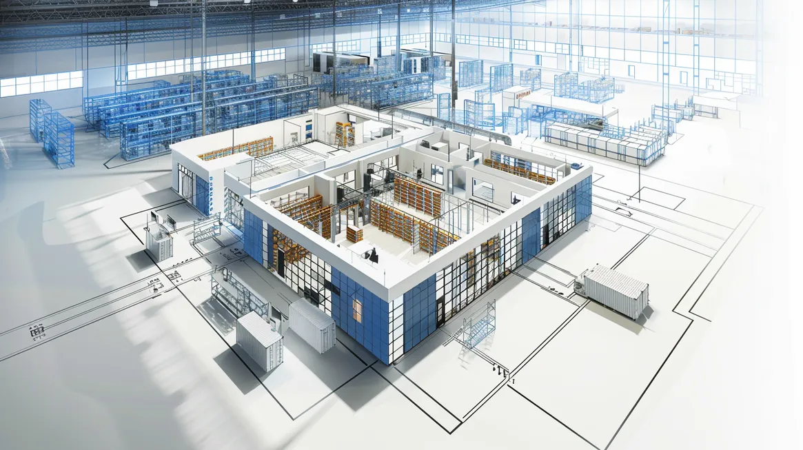
Revit Models (Scan-to-BIM) for Design, Coordination, and Documentation
At GeospatialWorx, our Revit Models service delivers highly accurate, BIM-ready models derived from detailed 3D laser scans or as-built survey data. Created to support architects, engineers, and construction professionals, these models provide a reliable digital foundation for design, coordination, and documentation — ensuring every m² is measured, modelled, and managed with precision.
What is a Revit (Scan-to-BIM) model?
Revit models are intelligent, 3D digital representations of existing buildings and structures. Unlike basic 2D CAD drawings, Revit models include real-world geometry, levels, and spatial relationships — allowing for design analysis, visualisation, and collaboration across multiple disciplines.
Our team produces Revit models directly from point cloud data, ensuring each element is dimensionally accurate and ready for immediate integration into your BIM workflows.
Why Use Revit Models?
- BIM-Ready Accuracy – Models are generated from precise 3D laser scans for dependable real-world accuracy.
- Seamless Collaboration – Simplify coordination between architects, engineers, and contractors.
- Design Confidence – Use accurate as-built geometry to plan refurbishments, fitouts, or extensions.
- Visual Clarity – Enhance understanding of building layouts through detailed 3D visualisation.
- Flexible Output – Receive models tailored to your required Level of Detail (LOD) and project scope.
Our Process
1. Data Collection
We begin by capturing on-site measurements using Leica 3D laser scanners.
2. Point Cloud Registration
Captured scans are processed and registered into a single, georeferenced point cloud for model creation.
3. Model Creation
Our technicians construct accurate Revit models, defining architectural, structural, and service elements according to your LOD (Level of Detail) requirements.
4. Delivery
Final models are supplied in Revit (.RVT) format, with optional exports to DWG, IFC, or PDF, ready for design and documentation use.
Made for
- Architects and Designers – Use as-built models as a base for design development and coordination.
- Engineers and Consultants – Integrate survey-accurate geometry into analysis and documentation.
- Construction and Fitout Teams – Verify conditions and plan works with confidence.
Technology We Use
- Leica 3D Laser Scanners
- Leica Cyclone REGISTER 360 for scan registration
- Autodesk Revit for model creation
- BricsCAD for drawing integration
Deliverables
- Revit Model (.RVT) – Survey-accurate, BIM-ready file
- 2D Drawings (DWG / PDF) extracted from model
- Registered Point Cloud (.RCP / .E57)
GeospatialWorx delivers Revit models built on verified survey data — giving design teams the accuracy, detail, and confidence to make every m² count.
Realiable Revit Models for Refurb, Fitout and Tenant Works
Reach out to the team directly and we’re happy to help.
Frequently Asked Questions
What LOD (Level of Detail) do you provide?
Common requests are LOD 200–300 or equivalent. We’ll match your BIM execution plan and keep scope lean to what you actually need.
What accuracy can I expect?
Models are traced directly from survey-grade point clouds. Typical positional tolerance is ±10-15mm for architectural elements, with tighter targets available for critical scopes
Which diciplines do you include?
Baseline is architectural; we can add structural and selected services (HVAC/risers/major plant) where visible in the scans. Full MEP can be quoted if required.
What file formats are provided?
Always RVT (native Revit). Optional IFC, DWG, and PDF. We can also deliver the registered point cloud (RCP/RCS or E57).
Do you following a modelling standard?
Yes — clean categories, naming conventions, materials, view templates, and a model audit checklist so your team can jump straight in.
Can you produce drawing sheets from the model?
Yes—plans/elevations/sections in DWG/PDF using our own existing conditions surveys teampltes.
Compliant
Experience
Experience
Expertise