
Existing Conditions Surveys
Detailed architectural floor plans, reflected ceiling plans and elevations & cross sections for design, documentation and fitout teams.
Made for Design & Fitout

Available Options
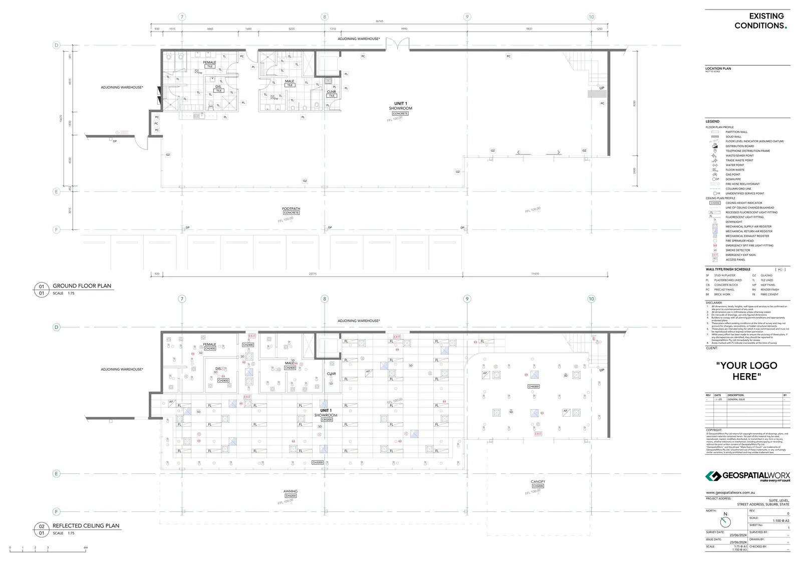
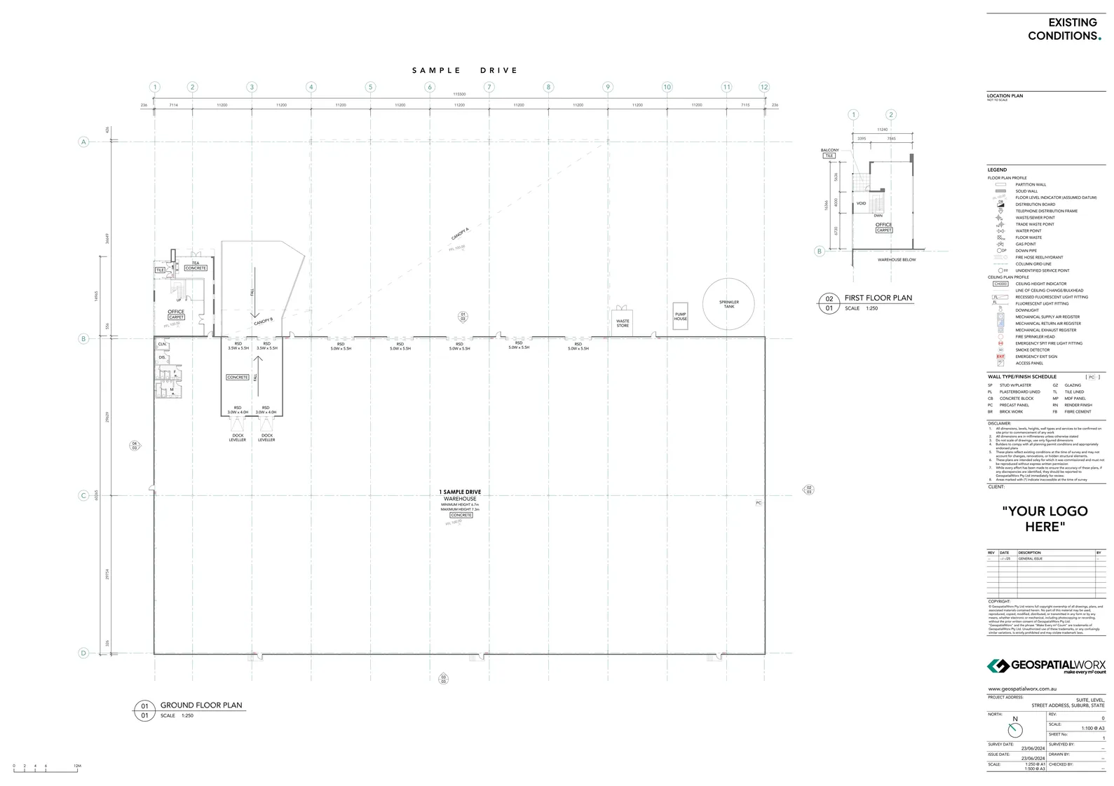
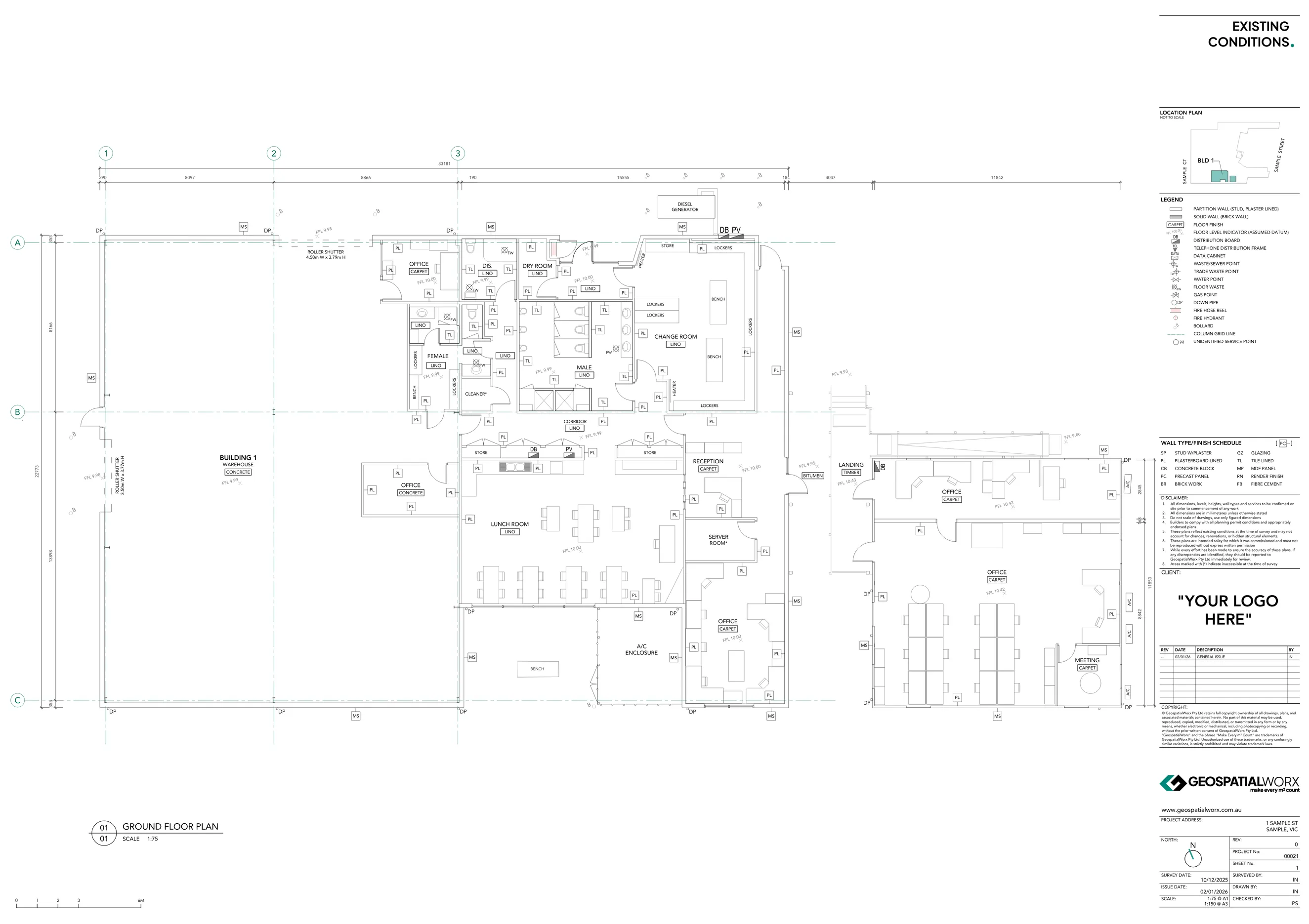
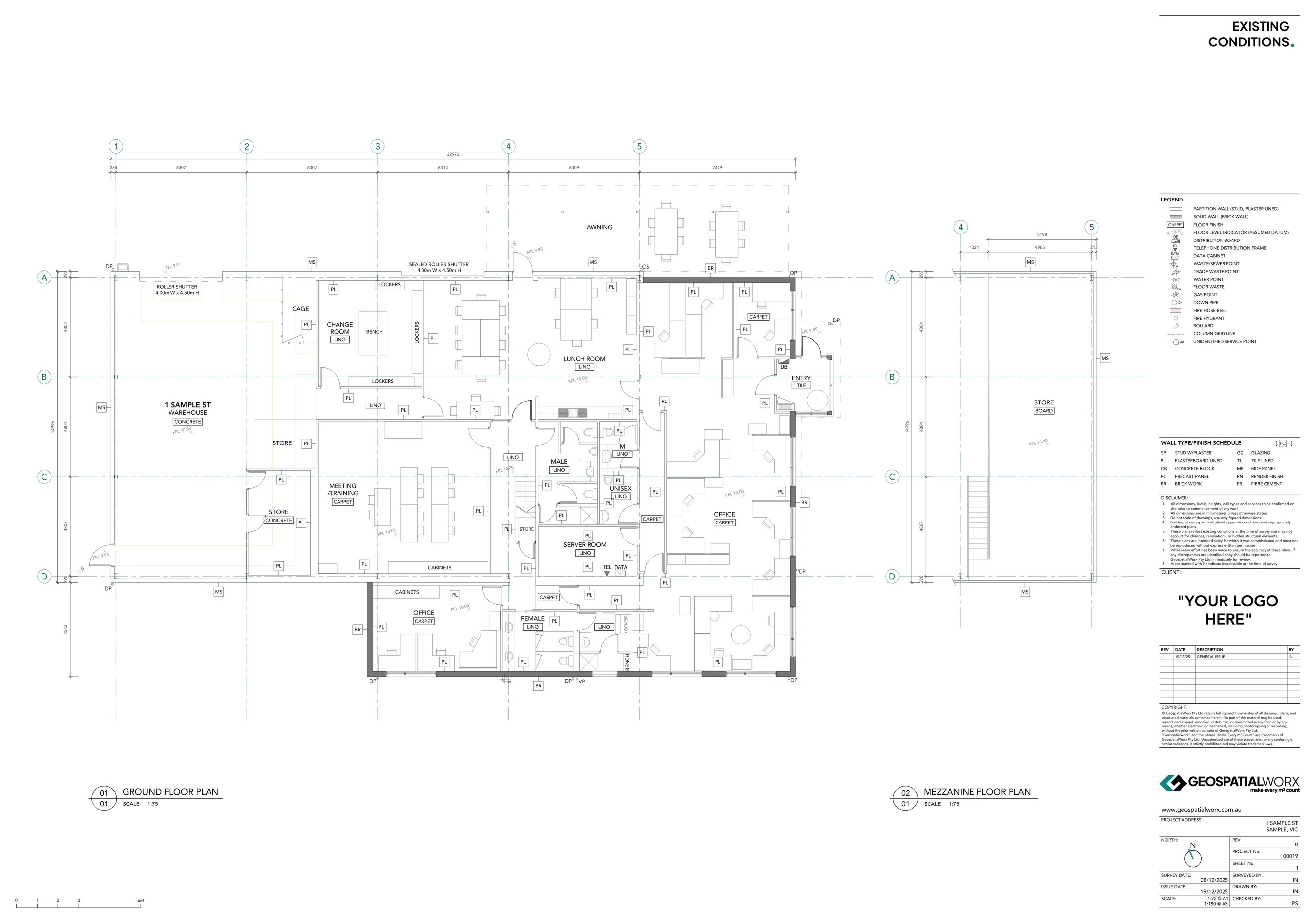
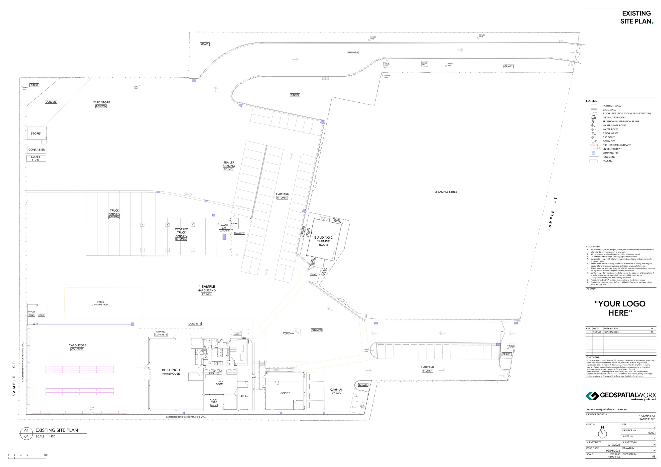
Existing Conditions Floor Plan
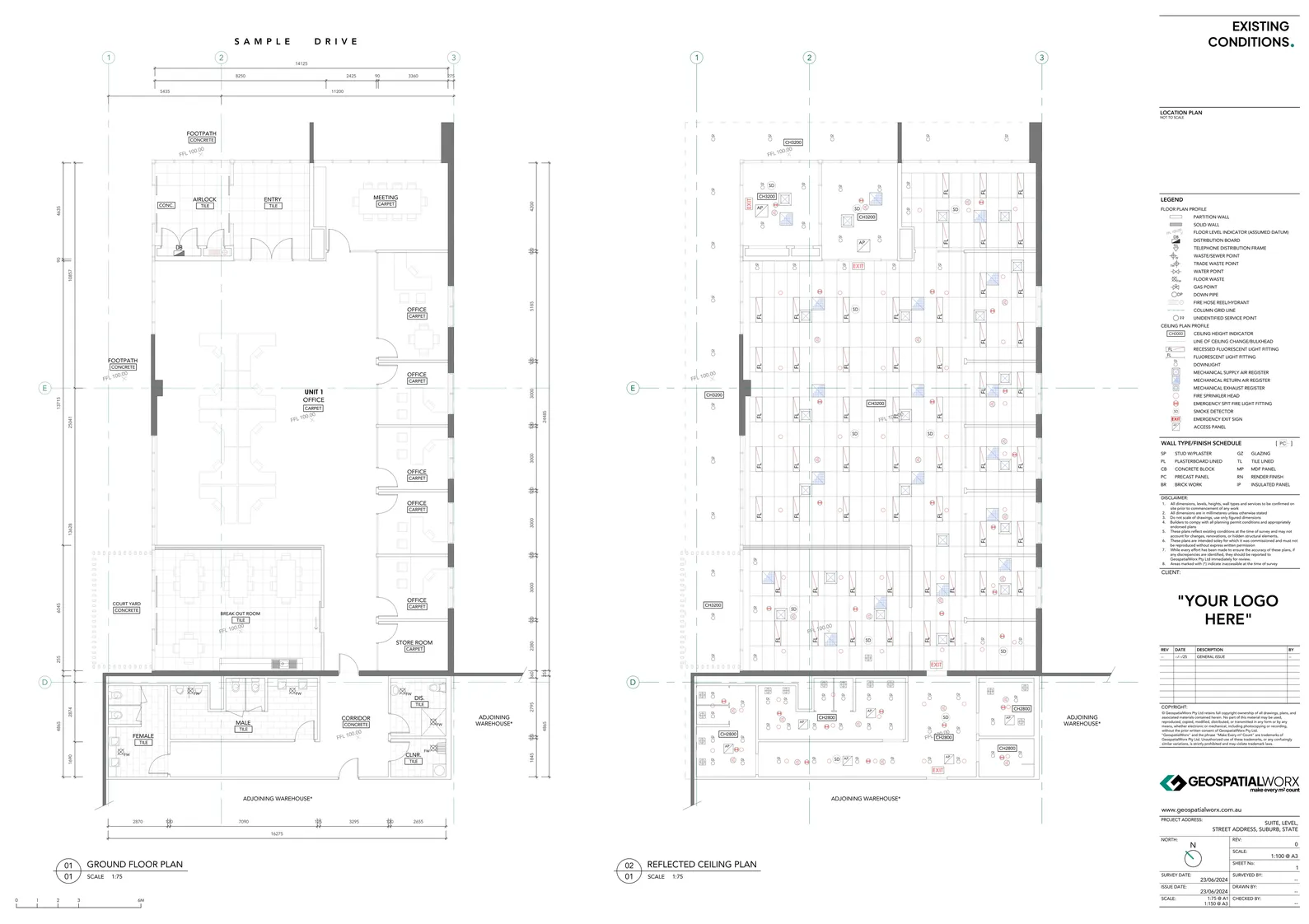
Reflected Ceiling Plans
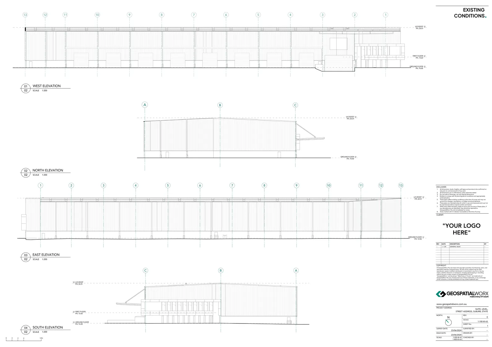
Elevations & Cross Sections
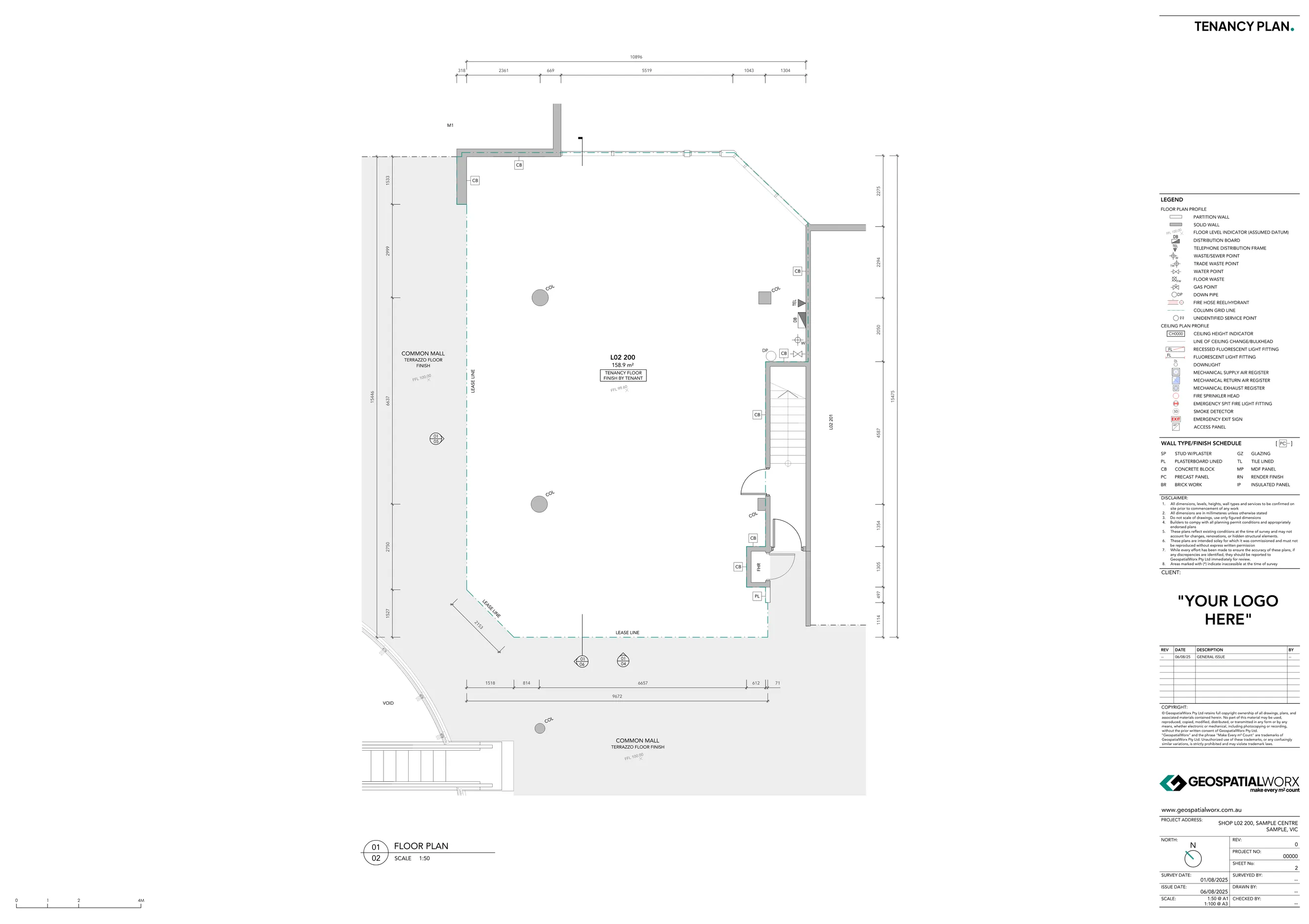
Retail Tenancy Plans
Get Your Existing Conditions Survey Today
Reach out to the team directly and we’re happy to help.
Existing Conditions Surveys for Design, Fitout, and Documentation
At GeospatialWorx, our Existing Conditions Surveys capture the true, as-built state of a building or site — providing architects, designers, and construction professionals with the accurate information they need to design, plan, and build with confidence. Each survey is measured with millimetre precision using 3D laser scanning and total station technology, ensuring every m² is documented accurately.
What Are Existing Conditions Surveys?
An Existing Conditions Survey (also known as an As-Built Survey) is a detailed measurement and documentation of a building’s current state — including detailed floor plans, reflected ceiling plans, external elevatons, cross sections, and site features.
These surveys are essential for projects involving renovations, refurbishments, or fitouts where accurate baseline data is critical. Our deliverables can include 2D plans, elevations, sections, or complete 3D Revit models depending on project requirements.
Why Use Existing Conditions Surveys?
- Accurate Foundation for Design – Eliminate guesswork with precise, verified building data.
- Time & Cost Efficiency – Reduce rework, clashes, and delays during construction.
- Comprehensive Documentation – Capture every visible detail, from structure to ceiling grids.
- Seamless Integration – Deliverables compatible with CAD, Revit, and BIM workflows.
- Trusted Results – All surveys conducted by experienced technicians using calibrated equipment.
Our Process
1. Site Scanning
We use Leica 3D laser scanners and total stations to capture complete site geometry and existing conditions.
2. Data Registration
Collected scans are registered into a single, unified point cloud, ensuring spatial accuracy across all levels.
3. Drafting
We produce the required 2D drawings from the point cloud using BricsCAD tailored to your project’s required level of detail.
4. Quality Assurance
Each plan is reviewed for alignment, accuracy, and presentation quality before release.
5. Delivery
Final deliverables are supplied in PDF & DWG, ready for immediate integration into design and documentation workflows.
Made for
- Architects and Designers – Use verified as-built data as a base for design development.
- Engineers and Consultants – Plan upgrades, refurbishments, and fitouts with confidence.
- Construction and Fitout Teams – Coordinate accurately between trades using reliable documentation.
Technology We Use
- Leica 3D Laser Scanners
- Topcon Total Stations
- Leica Cyclone Register 360
- BricsCAD
Deliverables Available
- CAD dwg
- Revit
- Point Cloud Files (.RCP or .E57)
GeospatialWorx delivers precise, audit-ready documentation of existing buildings — giving you the confidence to design, plan, and build with measurable accuracy in every m².
Get Your Existing Conditions Survey Today
Reach out to the team directly and we’re happy to help.
Frequently Asked Questions
What can be included in an Existing Conditions Survey?
Detailed floor plans, site plans, reflected ceiling plans, elevations and cross sections, 3D scan point cloud data, photo libraries-depending on your requirements.
What deliverables are available?
Clean, coordinated outputs in PDF and CAD dwg. We can also supply Revit models and pointcloud files (E57/RCP)
How precise are your surveys?
Millimetre-level capture - we use advanced laser scanning and total stations for high accuracy. All plans are quality checked before delivery.
Can you provide a Revit model/BIM from the scan?
Yes we can, refer to our Revit Model services page for more informtion.
Can you survey while the building is occupied?
Yes. We routinely work in live environments and have developed efficient means of data capture next to no disruption.
What if my needs are specialised?
No problems - can can custom tailor a existing conditions package to meet your needs.
Do you pick up services (MEP) and above-ceiling detail?
Visible fixtures are included by default. Above-ceiling/M&E as-builts can be added as an option and priced by area/complexity/means of suitable access & clearances.
Do you locate underground services?
No, we can refer you to a company and can work with them to tie their findings into our work if required.
Compliant
Experience
Experience
Expertise