
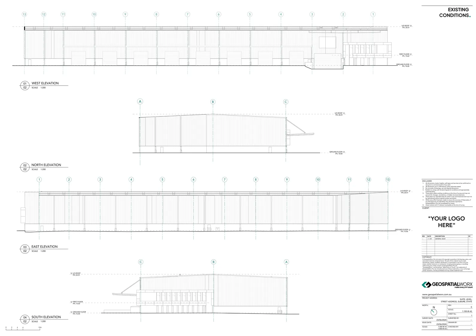
Elevations & Cross Sections
Our elevation and section drawings capture every vertical detail with precision. From façade documentation to interior sections, we provide architects and engineers with accurate references for design, modelling, and verification.
Made for Detailing

Get You Elevation or Cross Section Drawings Today
Reach out to the team directly and we’re happy to help.
Elevations & Cross Sections for Architectural and Structural Documentation
At GeospatialWorx, we produce Elevations and Cross Sections that accurately represent the vertical geometry and spatial relationships of buildings and sites.
Measured using advanced 3D laser scanning technology, our drawings deliver true-to-life documentation that architects, engineers, and designers can depend on — ensuring every structural and façade element is represented with precision.
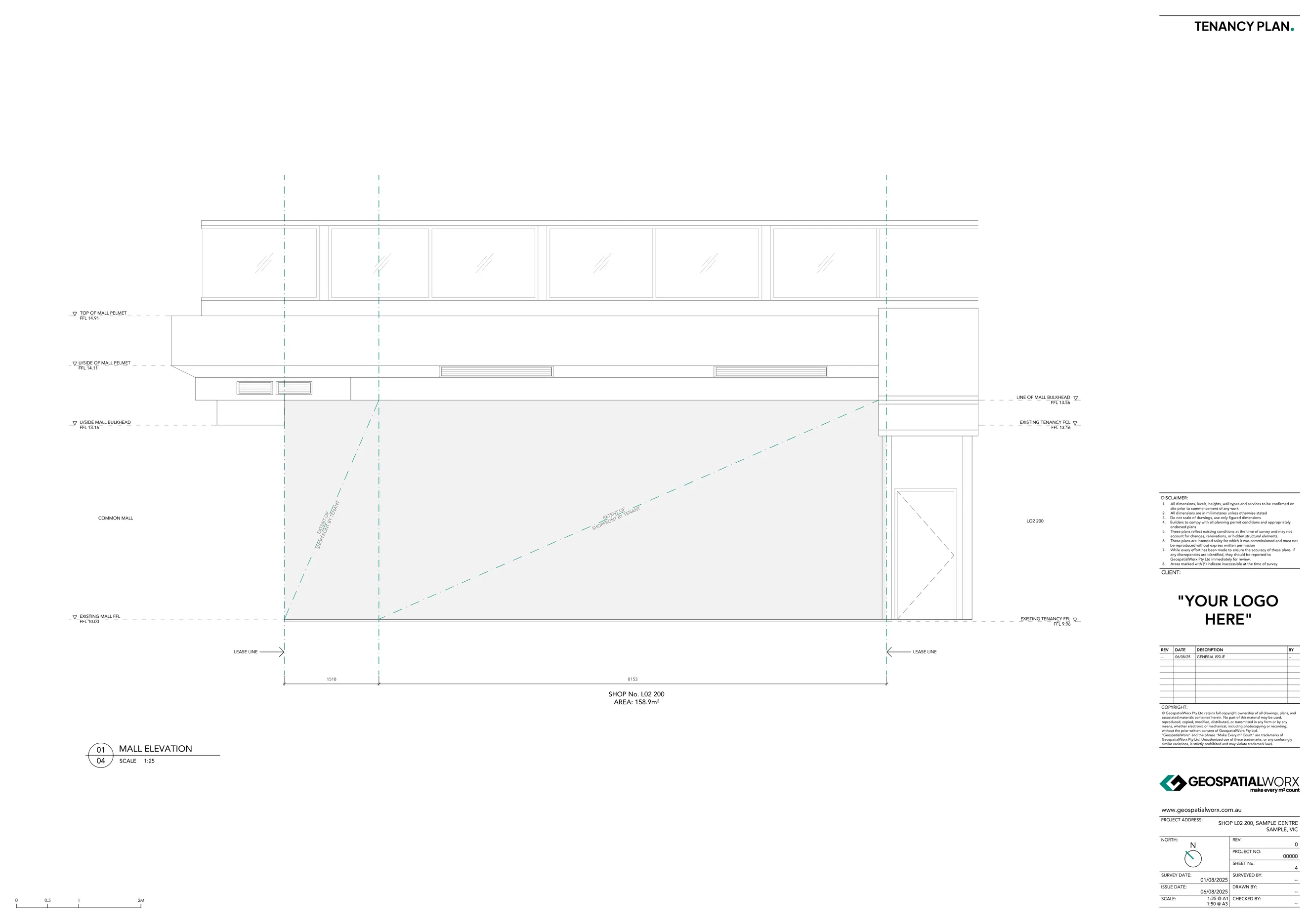
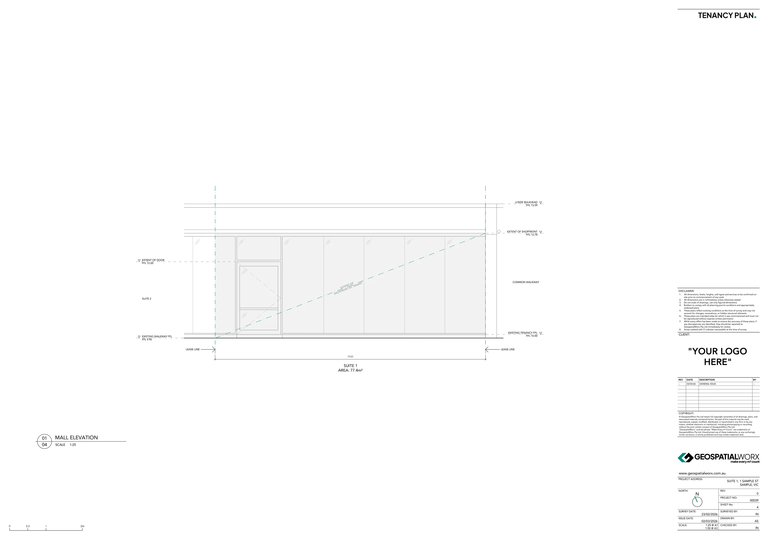
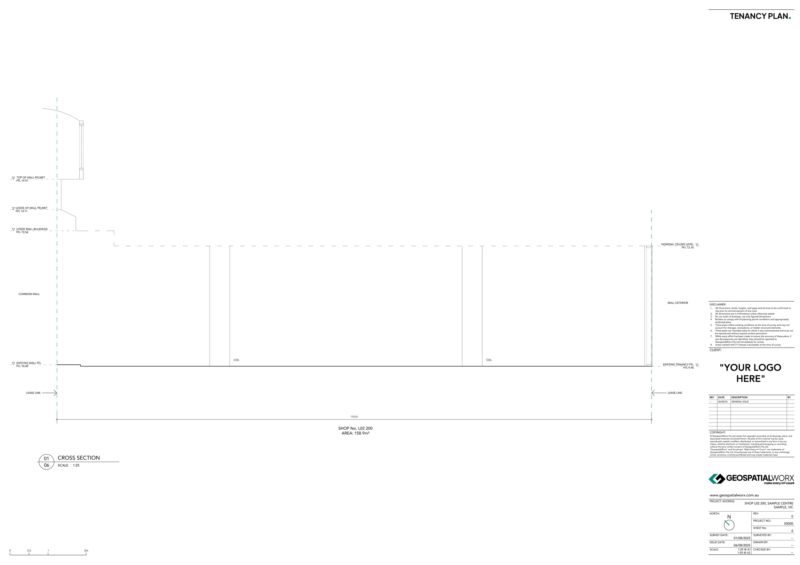
What Are Elevations and Cross Sections?
Elevations show the external or internal vertical faces of a building — including façades, openings, materials, and architectural details.
Cross Sections cut through the structure to reveal floor levels, wall construction, ceiling heights, and spatial relationships between key elements.
Together, these drawings form a critical part of design documentation and as-built verification, providing insight into both the visual and technical aspects of a structure.
Why Use Elevations and Sections?
- Design Precision – Develop accurate architectural or engineering drawings from verified data.
- Structural Understanding – Visualise internal relationships and dimensions between floors and walls.
- Façade Documentation – Capture every architectural feature, opening, and material transition.
- Renovation & Retrofit Ready – Ensure future design work starts with reliable measurements.
- Seamless BIM Integration – Compatible with CAD and Revit environments for modelling workflows.
Our Process
1. Site Scanning
We capture detailed 3D data of all exterior and interior elevations using Leica 3D scanners and elevated tripod systems to ensure coverage from ground to roofline.
2. Data Registration
Collected scans and survey data is registered into a single, unified point cloud, ensuring spatial accuracy across all areas and levels.
3. Drafting
From the point cloud, we generate 2D elevation and section drawings, tailored to your project’s level of detail.
4. Delivery
Final deliverables are supplied in PDF & DWG, ready for inclusion in architectural documentation, DA submissions, or design verification packages.
Made for
- Architects and Designers – Use verified elevations and sections as the base for design development.
- Engineers and Consultants – Plan structural and services work with precise spatial context.
- Builders and Contractors – Coordinate works and validate construction progress against as-built data.
- Facility Managers – Maintain detailed records of building form and materials for maintenance planning.
Technology We Use
- Leica 3D Laser Scanners
- Topcon Total Stations
- Leica Cyclone REGISTER 360
- BricsCAD
Deliverables Available
- CAD dwg
- Optional: Revit
- Optional: Point Cloud Files (.RCP / .E57)
Every vertical line matters — GeospatialWorx delivers elevation and section documentation that aligns design intent with site reality.
Get You Elevation or Cross Section Drawings Today
Reach out to the team directly and we’re happy to help.
Frequently Asked Questions
What information is shown by default?
Façade profiles, openings, sill/lintel heights, floor/soffit/beam/roof RLs, stairs/ramps, parapets, grids and key dimensions. Materials tagging and notes available on request.
Do you provide structural levels (RLs)?
Absolutely. We annotate RLs for slabs, beams, soffits, ridges/eaves and other critical points.
Can levels be set to an Australian Height Datum (AHD)?
Yes if required we can set all our levels to an Australian Height Datum. If not required they will be set to an arbrtriary datum.
Can you do internal elevations also?
Yes we can.
Do you require access inside a building to do external elevations?
No, the entire process of capturing external elevations can be done completely outside.
Compliant
Experience
Experience
Expertise